Registered with the Registrar of Newspapers for India under R.N.I 53640/91
Vol. XXVII No. 10, September 1-15, 2017
Celebrating Madras Week
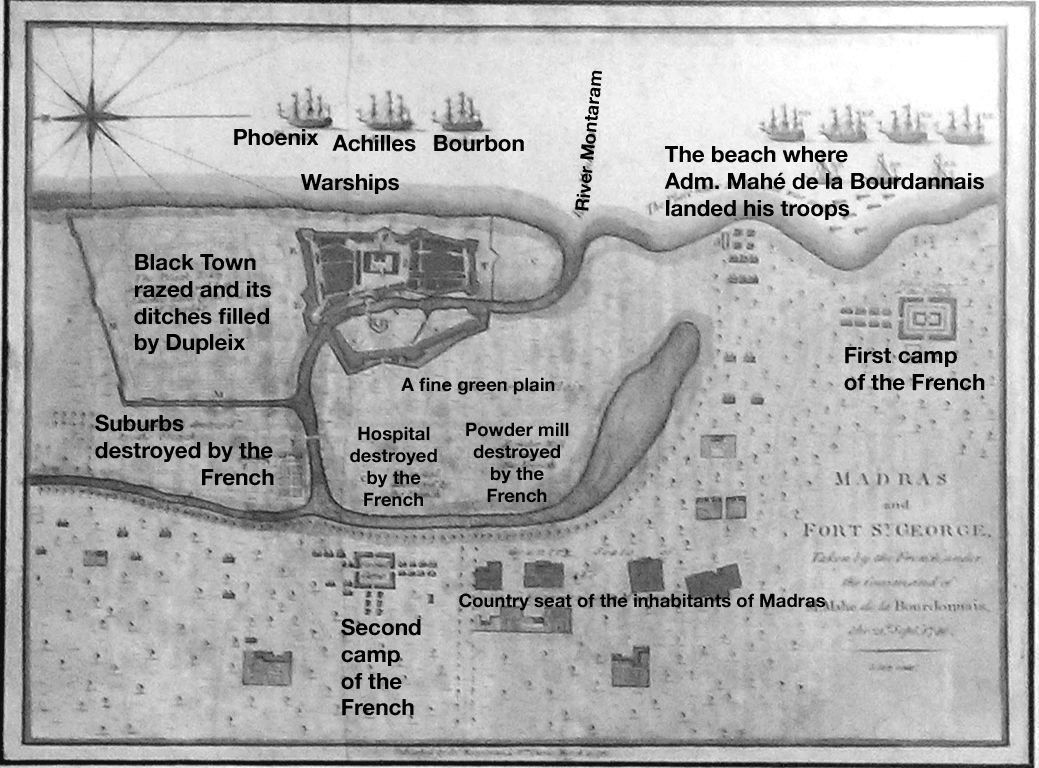
A 1746 story told in 1781
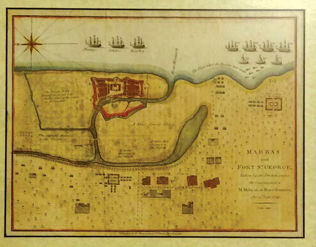 One of the highlights of Madras Week was the ‘The Coromandel in Maps 1705-1909’ exhibition held at Amethyst. It featured maps of India, South India, the Coromandel Coast and Madras (including a map of Pallavaram!) done by British, French and German cartographers. Each map had a story to tell – and the most fascinating one was the 1781 British map that told the story of Madras after its capture by the French in 1746.
Though we feature the map today, the writing on the print had faded quite a bit so today’s reproduction won’t let you read all it says. But the main features are indicated in a key map below:
Please follow and like us: